
February 2024: Susan Cohen
Associate Director at the University of North Carolina at Chapel Hill Institute for the Environment
“Any work that promotes, conserves, preserves [or] restores natural habitat that is conferring benefits to society is important… We’re here in North Carolina… but the value is everywhere.”
Susan Cohen
Why study the Currituck Sound? What makes this area significant?
Currituck is a fascinating place. It’s unique and different, especially in comparison to similar ecosystems on the coast such as the Albemarle-Pamlico. It’s essentially a freshwater sound, with a bit of salinity, and it’s tidal but by wind, creating a place that is altogether distinct. It also has huge habitat benefits; there are several rare and elusive species that live in Currituck. As well as a variety of coastal birds, from little sparrows to big wading birds, that rely on the Sound as critical habitat.
The Currituck is also significant to the communities around it, including those who engage in hunting and recreation. Local communities have been fishing in the Sound for generations. It’s the passion of these groups that often drives conservation efforts. The Sound also offers a multitude of ecosystem services, especially as it relates to water quality and storm protection. These marshes help filter water that runs down from North Carolina’s surrounding farmland. Ultimately, these marshes are hugely important, and we need to protect them.
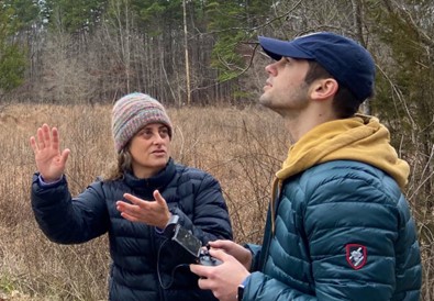
What makes drones a good fit for this project?
We always ask ourselves that question. What drones have to offer is different scales of data that otherwise are not available right now. For an area as intricate as the Currituck, satellite, and plane data– while allowing us to identify the overall trajectories of marsh erosion and movement– are not at the right scale if we really want to understand how the marsh is changing over time or how much shoreline is being lost. Satellite and plane data is not as refined as drone data can be, and it’s often not taken at the right time or at the right spatial scale. Drones can provide greater precision and less error. Of course, it’s still necessary to go on the ground and collect data. Drones are incredibly useful tools, but we can never get away from our work on the ground; it’s what helps us give meaning to and interpret our data.
What value do your partnerships with Elizabeth City State University and the Audubon of North Carolina contribute to this project?
Everything we do is collaborative. The challenges in Currituck are multidisciplinary; they require different people with lots of different knowledge and subject-matter expertise to help solve problems and strategically develop mitigations. Working with partners that bring valuable skills to the table is always relevant. ECSU has amazing experience in the aviation world. They also have a wonderful collection of sensors that have contributed heavily to our work. Audubon is one of the stewards of these marshes; we collaborate with them on their projects aimed at marsh resilience. Our work aims at improving the quality and quantity of data so that those who are stewards, like Audubon, can improve their decision making. It’s all very applied. Bringing collective partners together will only make the information stronger.
How does your research benefit North Carolinian citizens?
Any work that promotes, conserves, preserves or restores natural habitat that is conferring benefits to society is important. Any work that we do, regardless of the primary reason, confers a multitude of other benefits as well. There’s a huge list of things that you get by preserving and restoring this land. Ultimately, it’s not just the community around the Sound, but everyone in North Carolina who benefits. The lessons learned from this project will travel among those who interact with similar systems– different groups of scientists, managers, and community members– helping to inform better science and management throughout the state.